Log in
All resources
Create a design
33,250 Free Images of Astronomical Maps
maps in the library of congress
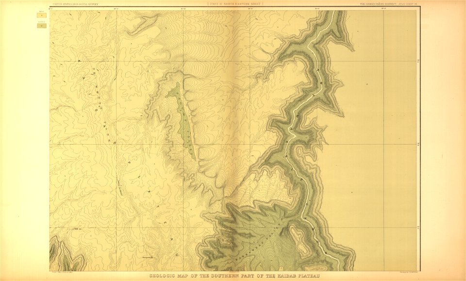
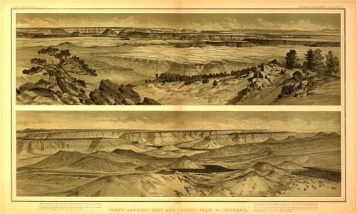
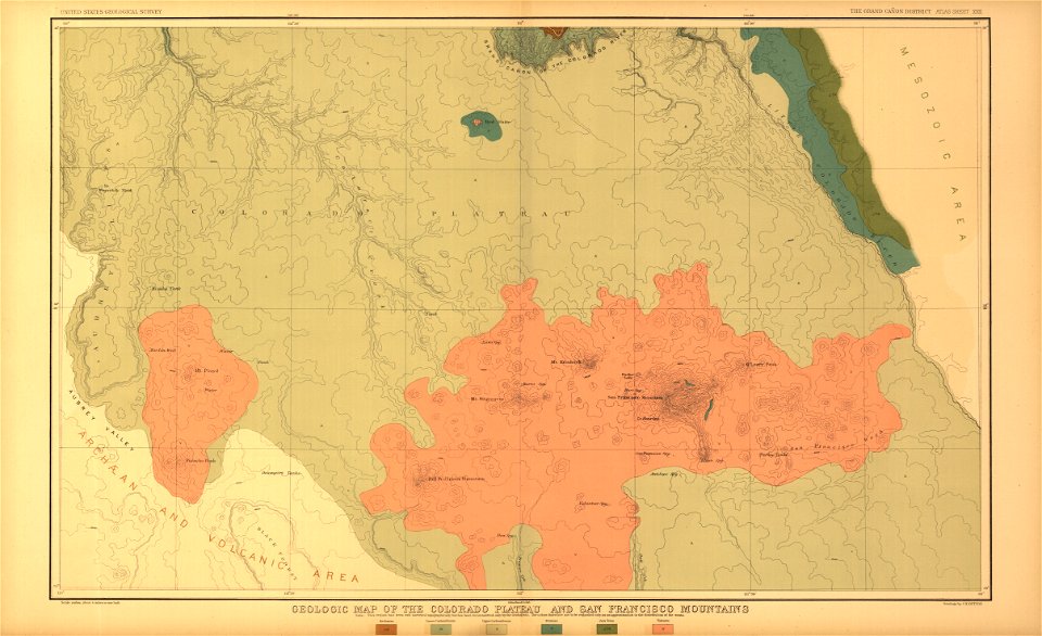
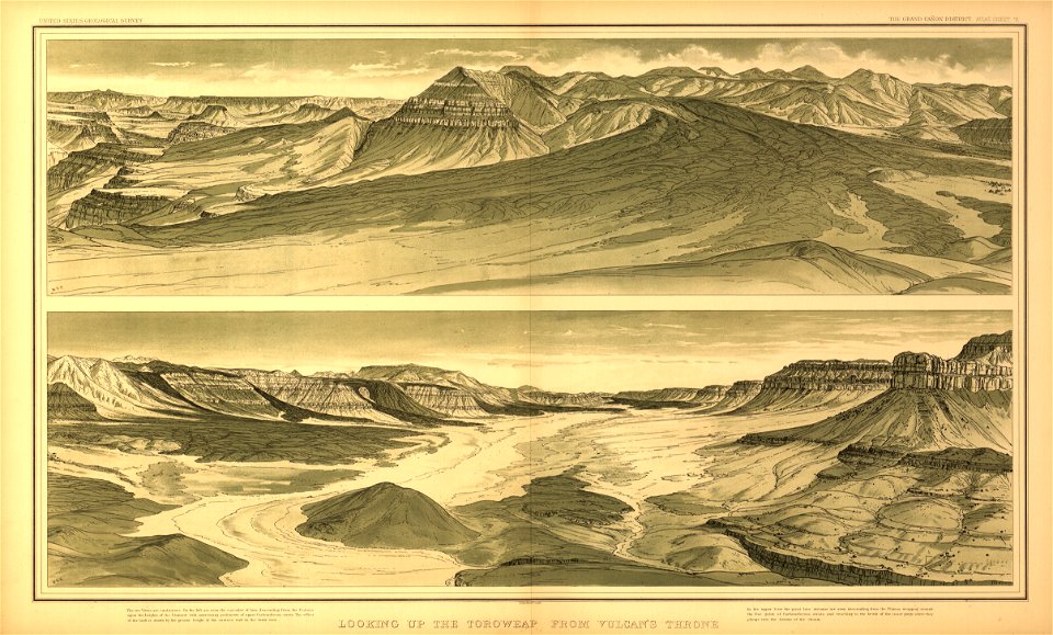
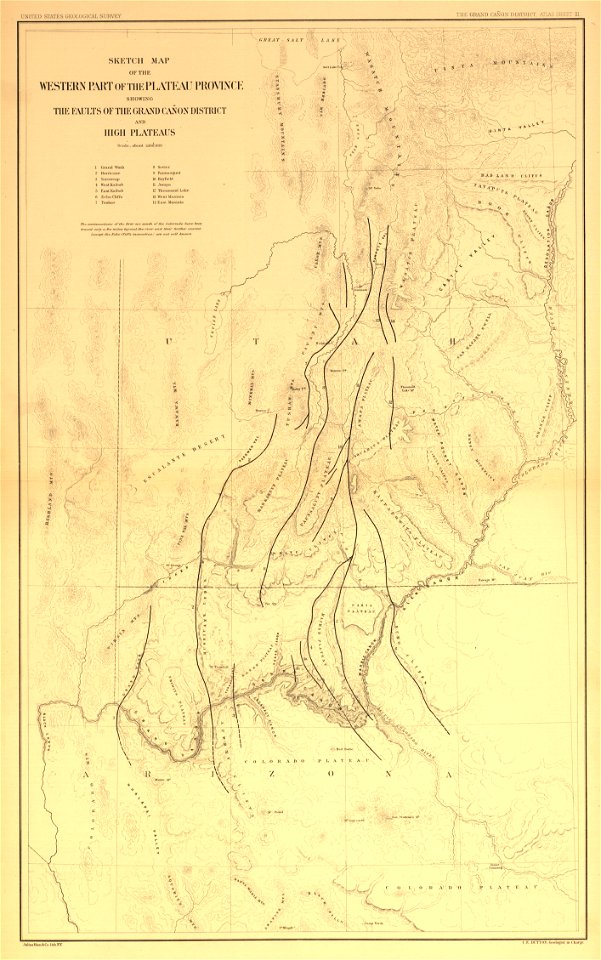
tertiary history of the grand cañon district
..
with atlas
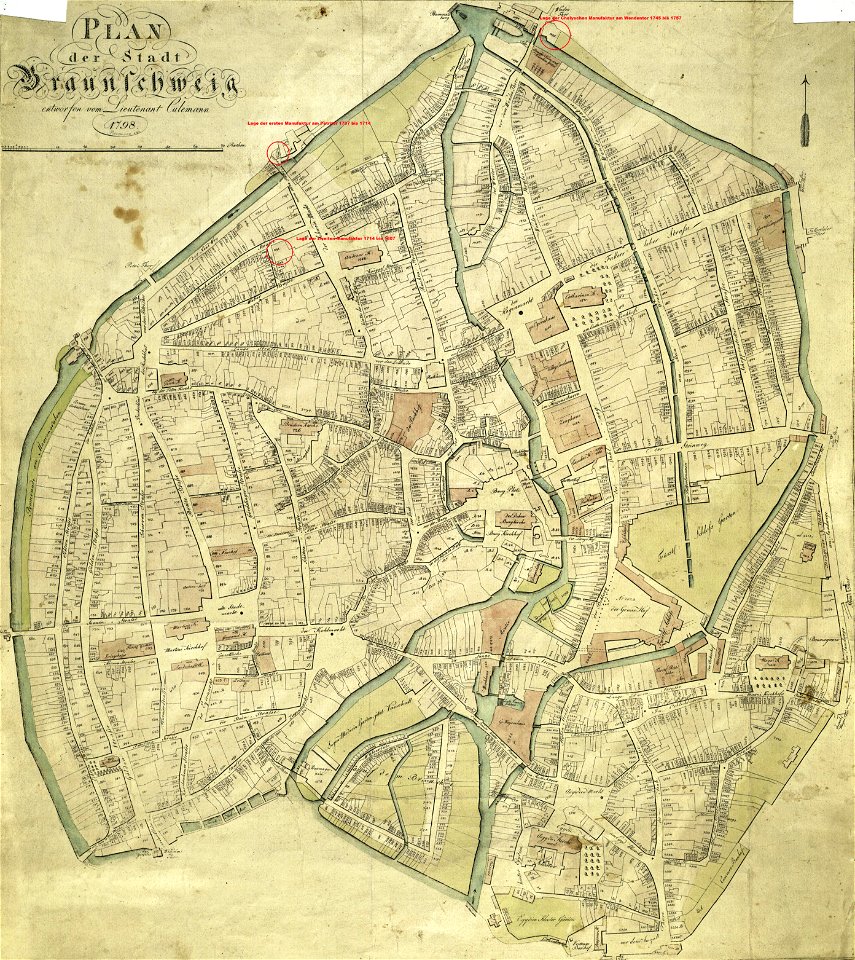
old maps of braunschweig
collections of stadtarchiv braunschweig
braunschweig in the 1790s
friedrich wilhelm culemann
geographical illustrations by coronelli
cornell: persuasive cartography: the pj mode collection
prints from the peace palace library
1652
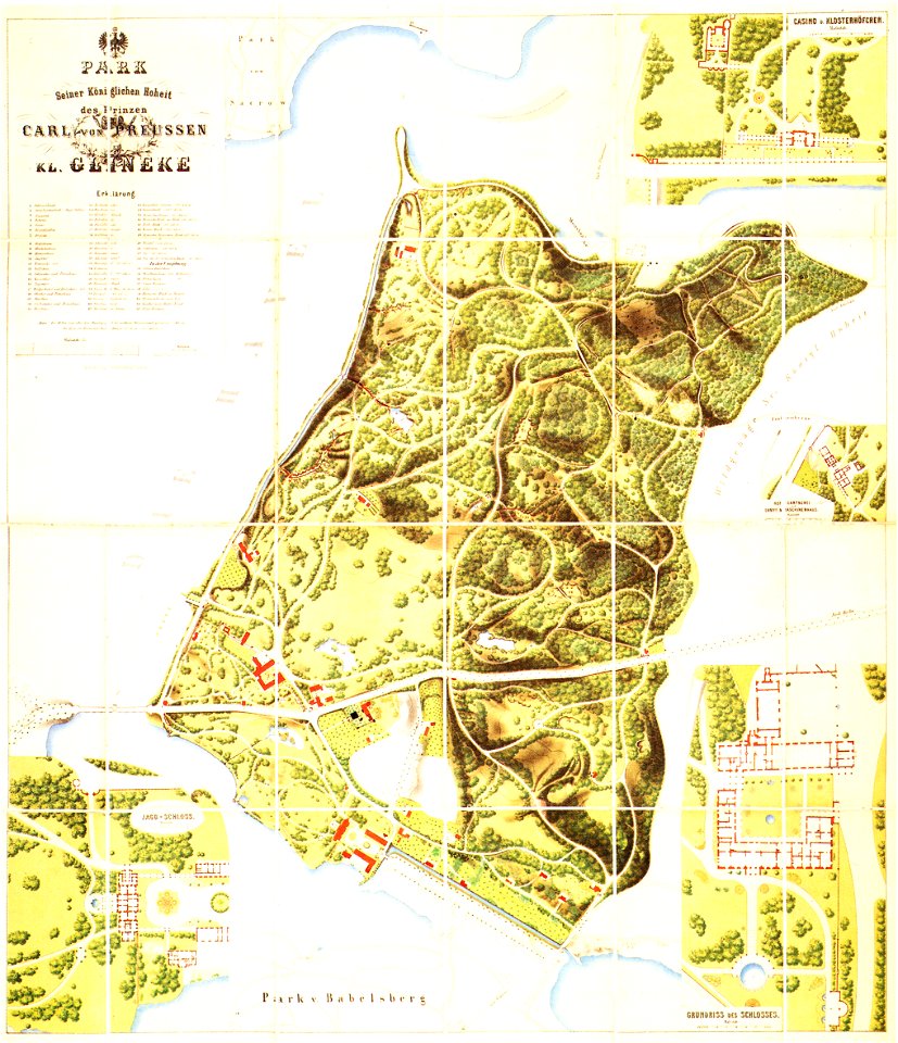
königstraße (berlin-wannsee)
glienicker brücke
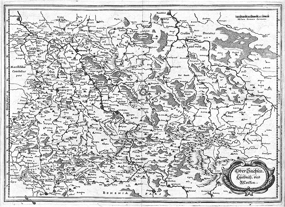
engravings of topographia superioris saxoniae
thüringiae
images from bau- und kunstdenkmäler des regierungsbezirks wiesbaden (volume 2)
maps of frankfurt-höchst
17th-century fortress plans
military trenches
geographical illustrations by coronelli
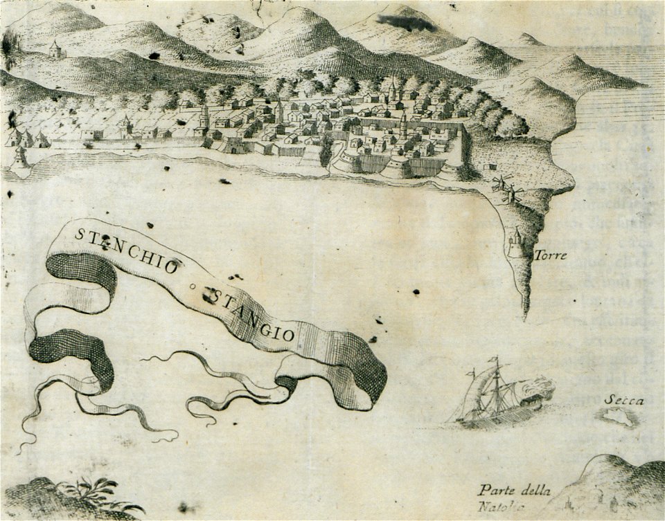
history of the dodecanese
engravings of topographia bohemiae moraviae et silesiae
maps of the history of breslau (wrocław)
maps and topographical views by joris hoefnagel
castle of szolnok
school children in art
classrooms in art
great siege of malta paintings at the royal museums greenwich
old maps of valletta
bonds and shares of edhac members
mendrisio electric tramway
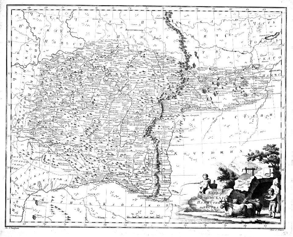
maps of the history of bashkortostan
atlas of the russian empire (1792)
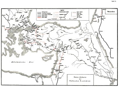
history of rail transport in turkey
enzyklopädie des eisenbahnwesens
old maps of cities in sweden
landskrona
prints from marana espion turc at the peace palace library
maps of the dardanelles
prints from marana espion turc at the peace palace library
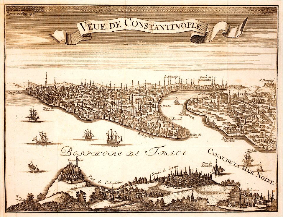
old maps of constantinople
illustrations de l'histoire de la nouvelle france d'eugène guénin
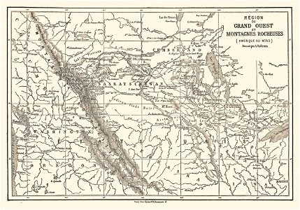
maps of the rocky mountains
painters from bohemia
josef mánes
planet
space
novus atlas sinensis
old maps of jiangsu
an accurate map of england and wales , drawn from all the particular surveys hitherto publish'd. illustrated with many additional improvements, and regulated by numerous astronomical observations made by... - btv1b53181614s
maps by thomas kitchin
an accurate map of england and wales , drawn from all the particular surveys hitherto publish'd. illustrated with many additional improvements, and regulated by numerous astronomical observations made by... - btv1b53181614s
maps by thomas kitchin
magni ducatus lithuaniae
details of old maps
maps from the earth and its inhabitants, vol. vi
exploration of asia
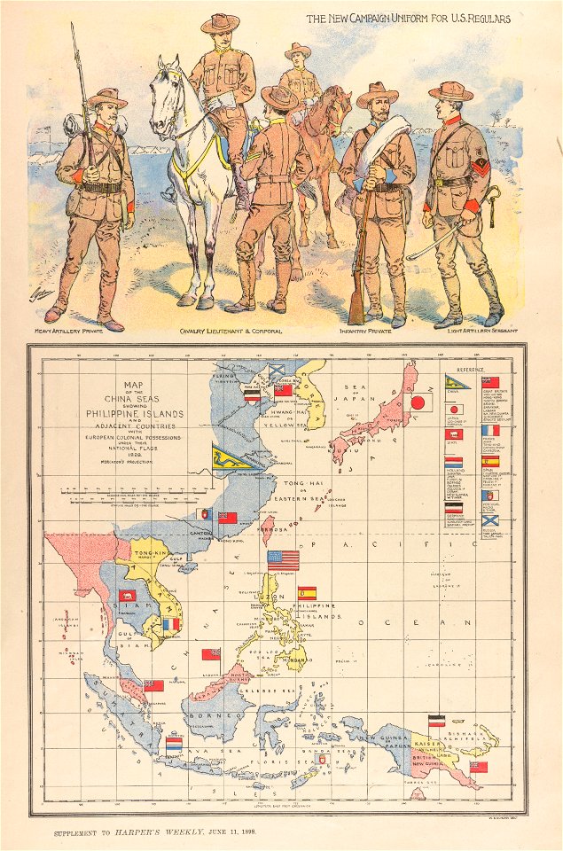
philippine sea
1898
atlas van der hagen (volume 4)
maps with cartouches
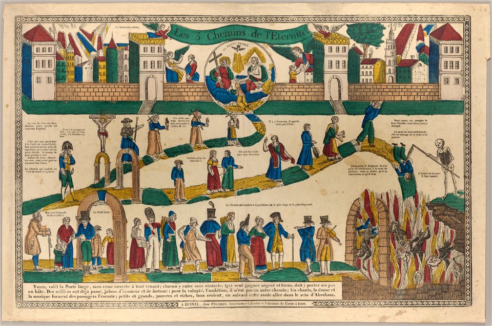
heaven
hell
schloss friedenstein (gotha)
gotha
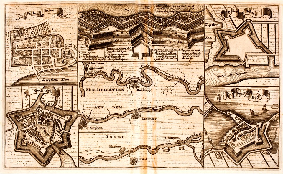
fortifications in the netherlands
zwartsluis
maps made in the 17th century
gerard valck
chromolithograph
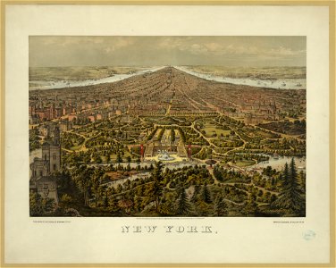
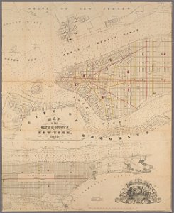
new york city
1677 paintings
1677 maps
chromolithograph
new york city
cornell university library
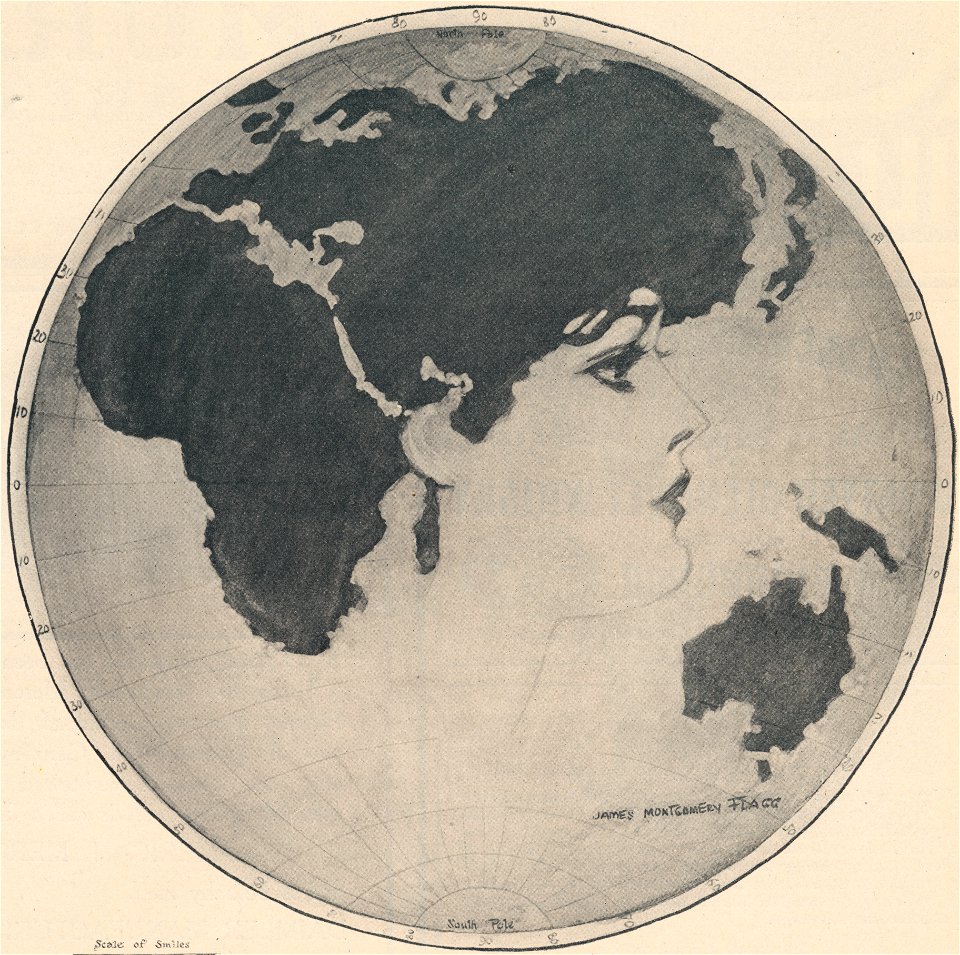
gibson girl
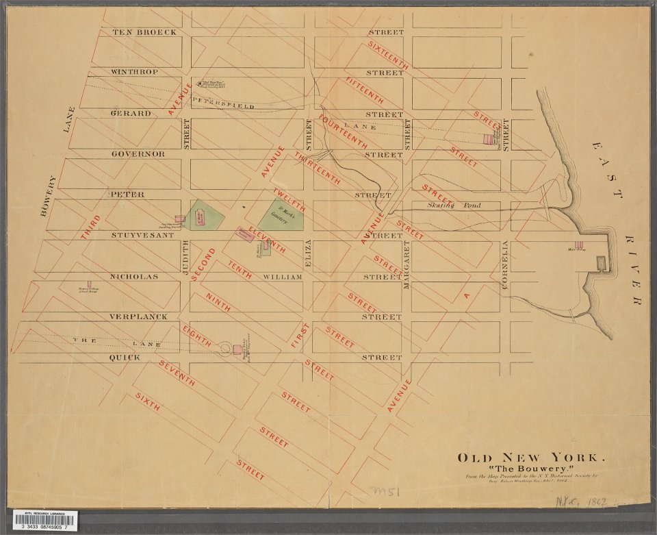
new york city
bowery
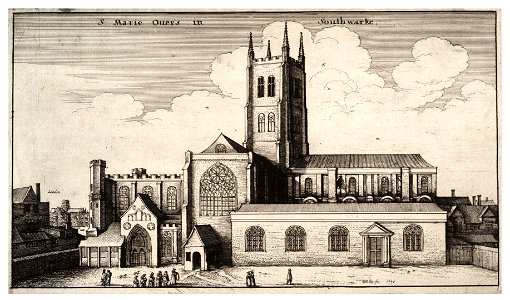
prints in the royal collection of the united kingdom
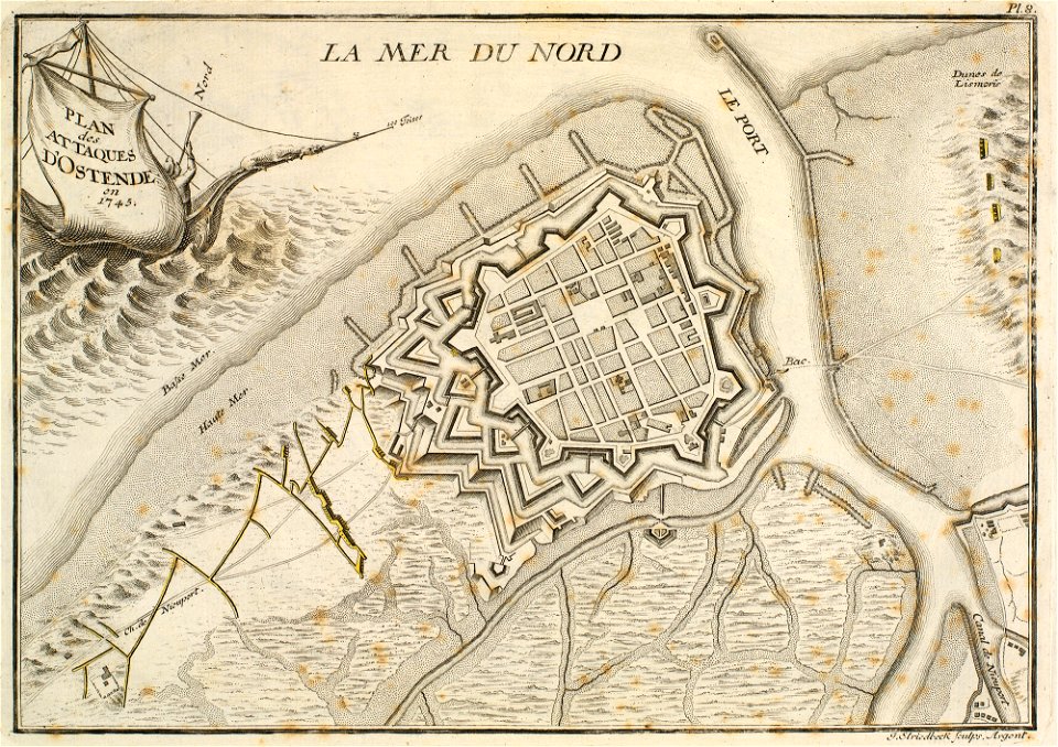
history of ostend
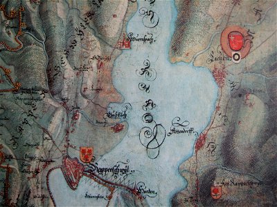
historical images of rapperswil
mariazell wurmsbach abbey
george hayward
new york city
maps in the royal collection of the united kingdom
1746
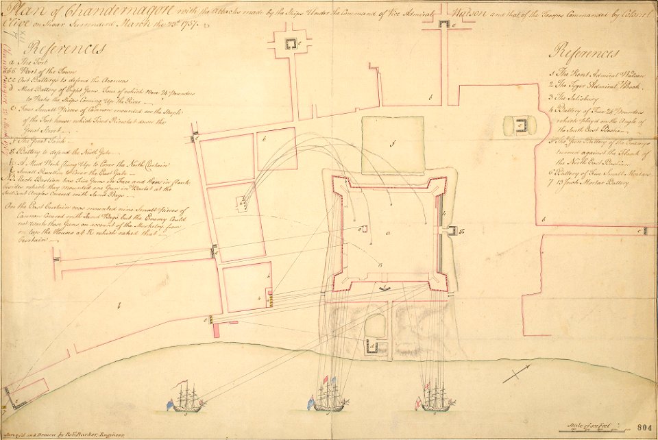
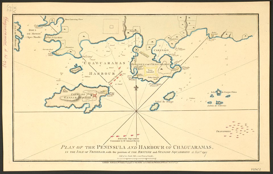
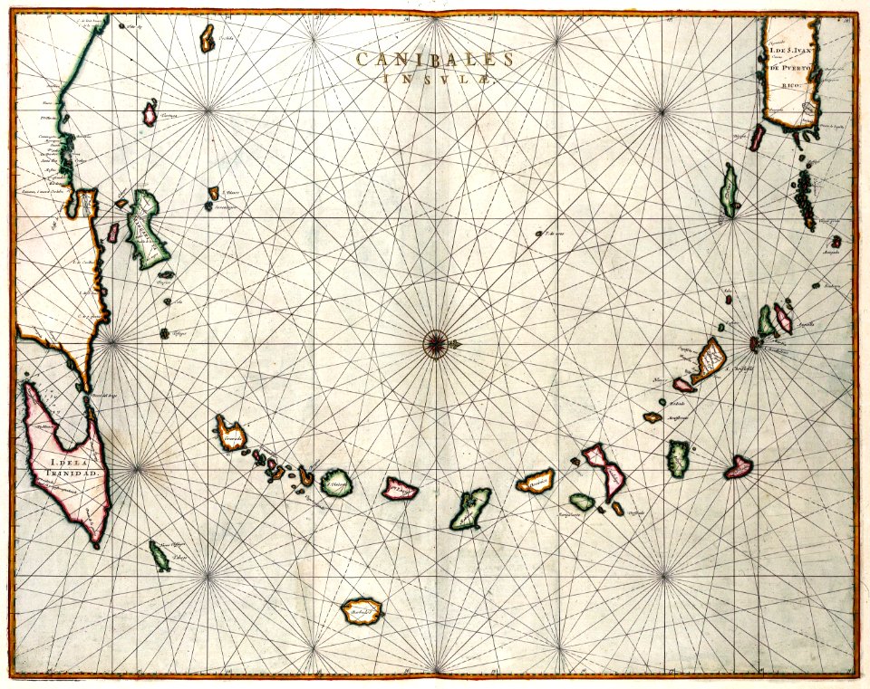
18th-century maps of trinidad and tobago
history of trinidad and tobago
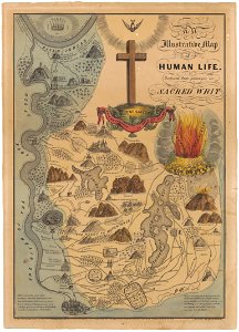
heaven
hell
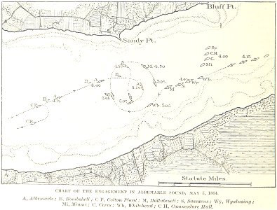
1862
1864
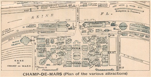
exposition universelle (1900) champ-de-mars
engravings of paris
francis d'avignon
north america
history of rail transport in ireland
enzyklopädie des eisenbahnwesens
printing
1869
collections of stadtarchiv braunschweig
old maps of braunschweig
maps and topographical views by joris hoefnagel
drawings by joris hoefnagel
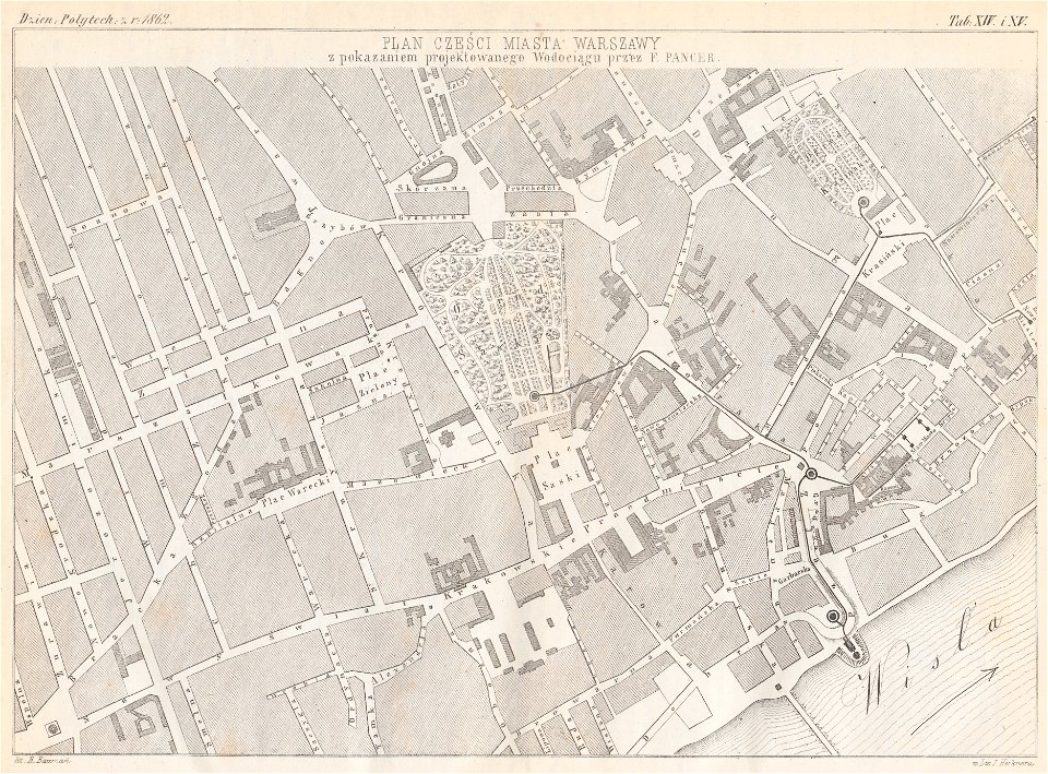
warsaw in the 1860s
feliks pancer
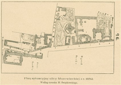
królewska street in warsaw
historical maps of warsaw
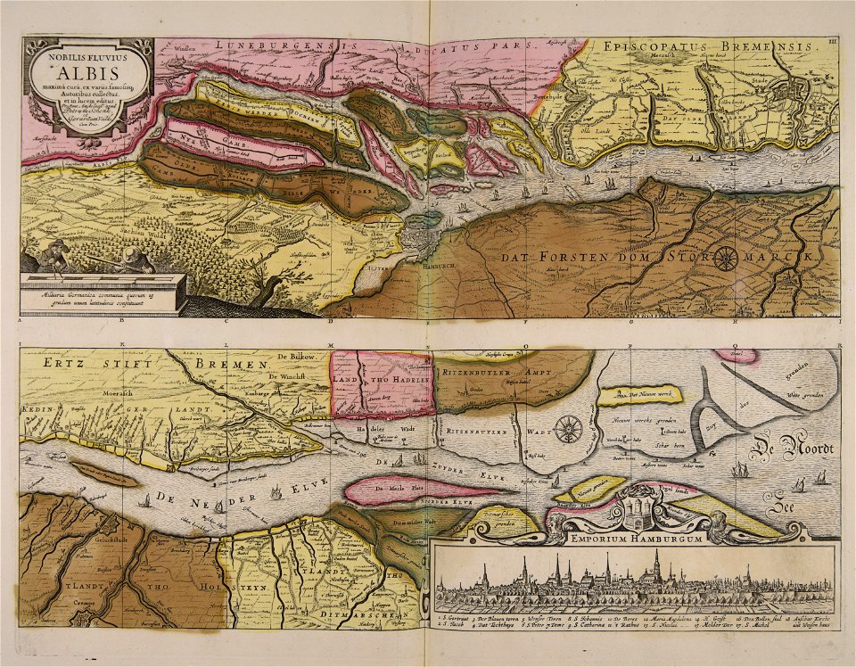
ämteratlas des fürstentums lüneburg von johannes mellinger
elbe in lower saxony
engravings by matthäus merian
historical maps of plzeň
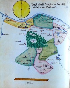
collections of stadtarchiv braunschweig
old maps of braunschweig
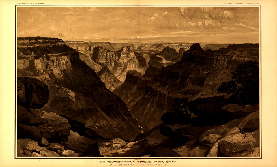
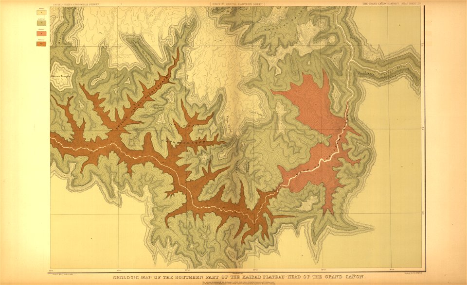
tertiary history of the grand cañon district
maps in the library of congress
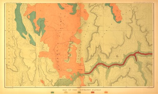
tertiary history of the grand cañon district
maps in the library of congress
tertiary history of the grand cañon district
maps in the library of congress
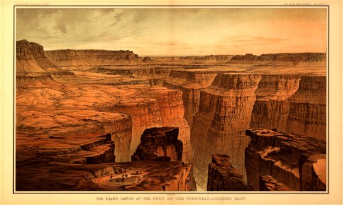
tertiary history of the grand cañon district
maps in the library of congress
tertiary history of the grand cañon district
maps in the library of congress
tertiary history of the grand cañon district
maps in the library of congress
tertiary history of the grand cañon district
maps in the library of congress
tertiary history of the grand cañon district
maps in the library of congress
tertiary history of the grand cañon district
maps in the library of congress
tertiary history of the grand cañon district
maps in the library of congress
tertiary history of the grand cañon district
maps in the library of congress
tertiary history of the grand cañon district
maps in the library of congress
drawings and watercolours of the royal museums greenwich
printing
atlantis magni tomus primus (biblioteca comunale di trento)
17th-century maps of sweden
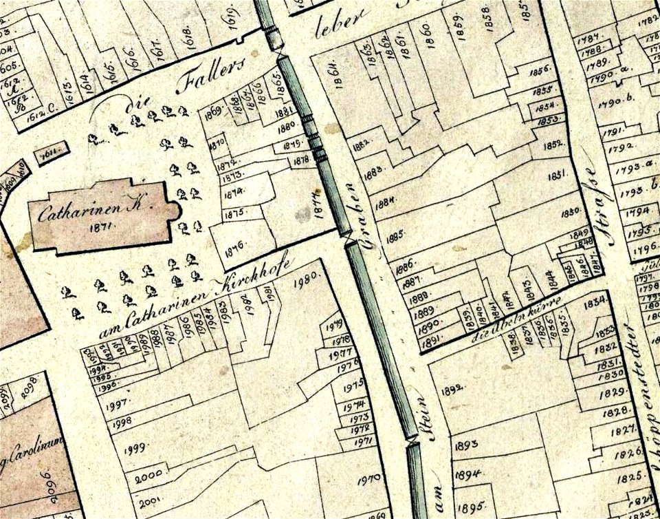
collections of stadtarchiv braunschweig
old maps of braunschweig
collections of stadtarchiv braunschweig
old maps of braunschweig
collections of stadtarchiv braunschweig
old maps of braunschweig
maps in the national library of australia
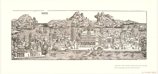
venice in art
soldiers in art
ink drawing
engravings by jan luyken
1696
geographical illustrations by coronelli
old maps of the peloponnese
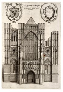
university of toronto wenceslas hollar digital collection
hollar maps and plans of london
university of toronto wenceslas hollar digital collection
hollar maps and plans of london
isle of wight
anglesey
drawings (documentary) collection in the library of congress
1860 in art
drawings (documentary) collection in the library of congress
1860 in art
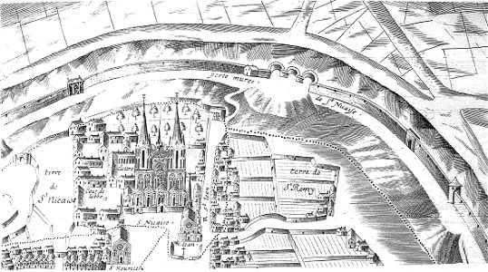
bibliothèque municipale de reims
maps of reims
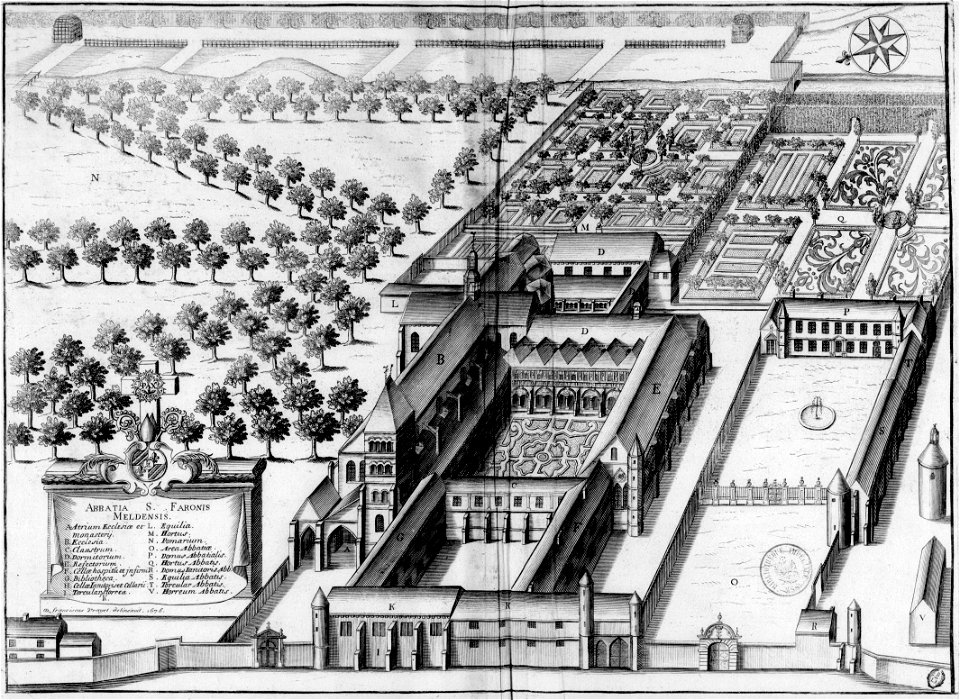
monasticon gallicanum
maps of meaux
1818 watercolor paintings
vilenica cave
illustrations from césar cascabel by george roux
19th-century maps of the americas
maps with cartouches
lesser antilles
maps with cartouches
atlas van der hagen
atlantis magni tomus quintus (biblioteca comunale di trento)
maps made in the 17th century
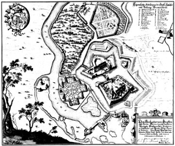
engravings of topographia saxoniae inferioris
bremen-verden campaign
maps by gerardus mercator
mercator celestial globe
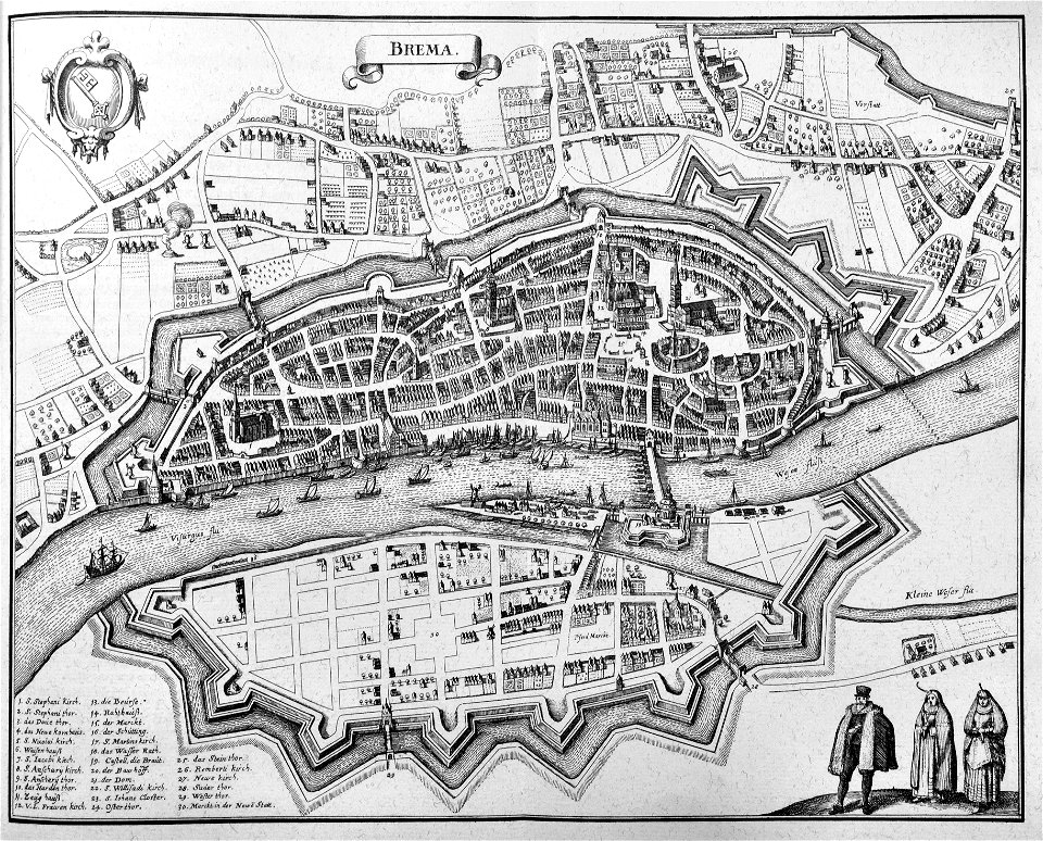
old maps of bremen (state)
bremen in the 1650s
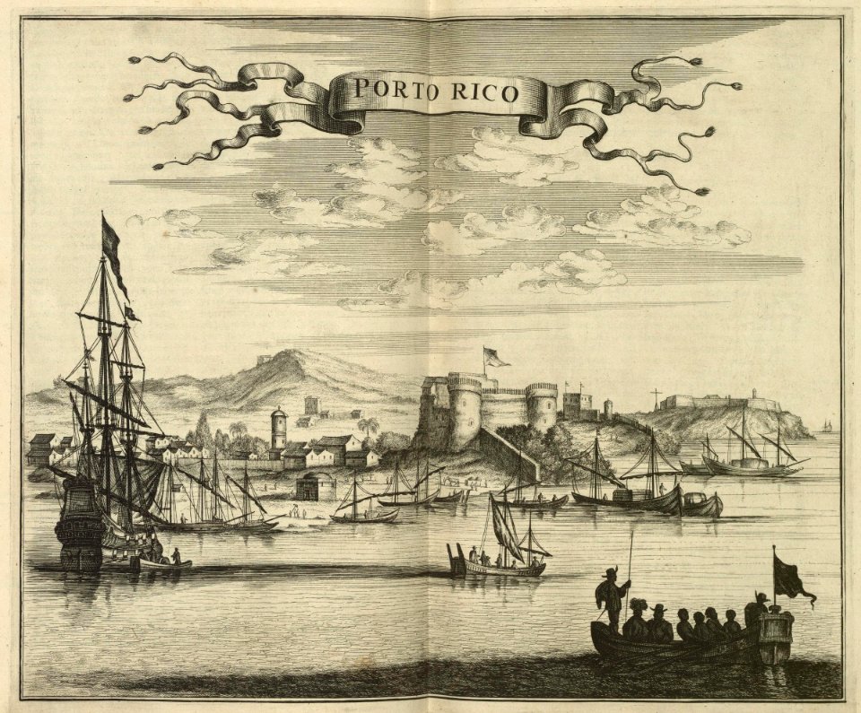
la fortaleza
puerto rico
johannes janssonius waasbergen
1672
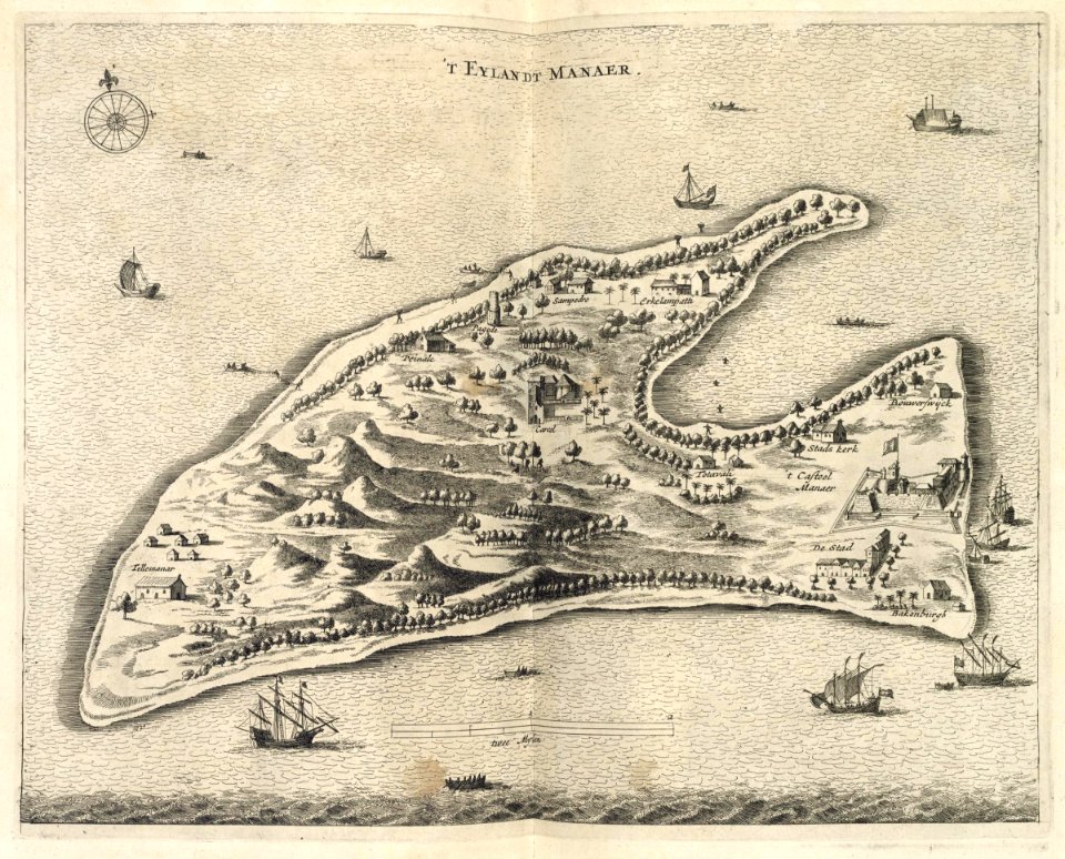
pulicat
1672
maps of the dutch east india company - sri lanka
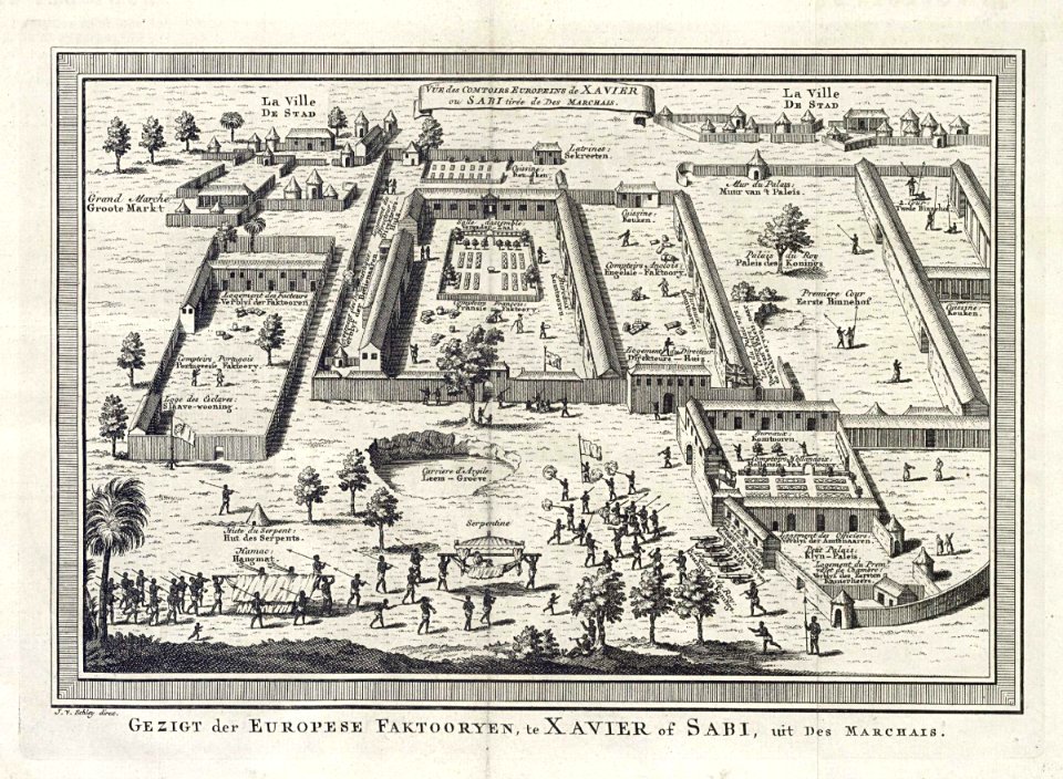
1726
jacobus van der schley
savi
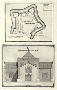
atlas de wit 1698
frederick de wit
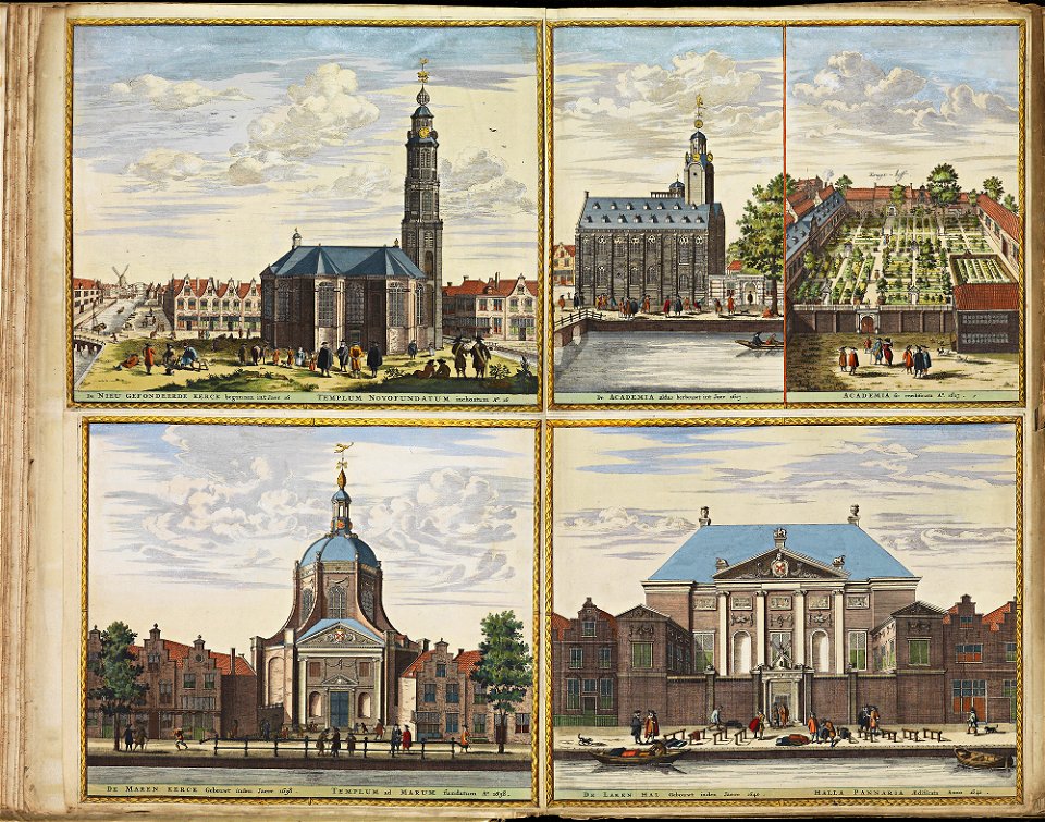
old maps of dokkum
atlas de wit 1698
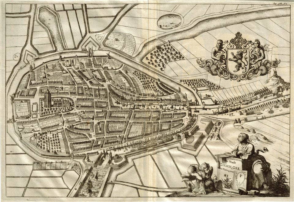
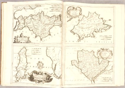
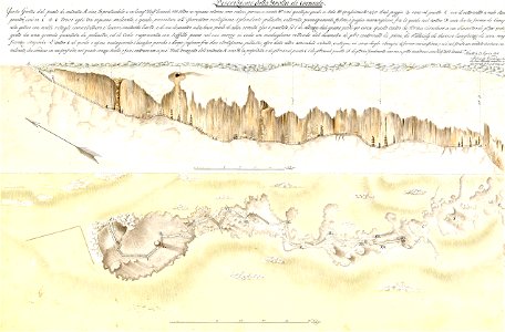
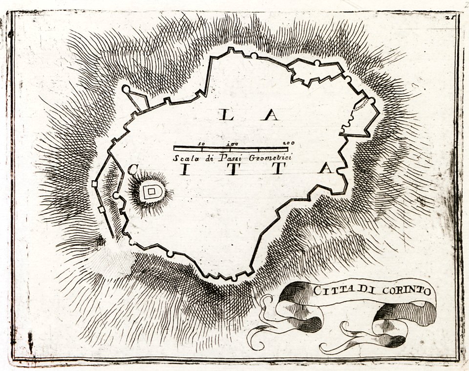
geographical illustrations by coronelli
old maps of the peloponnese
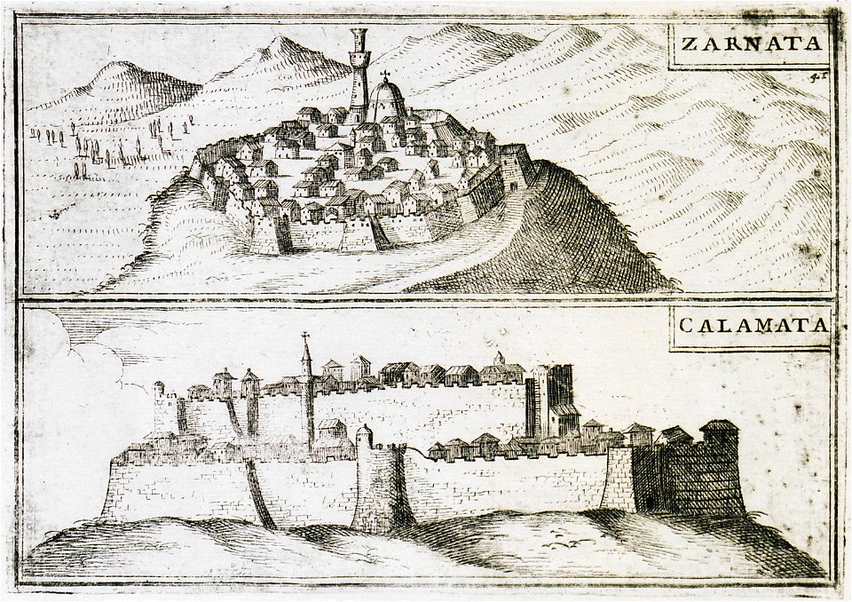
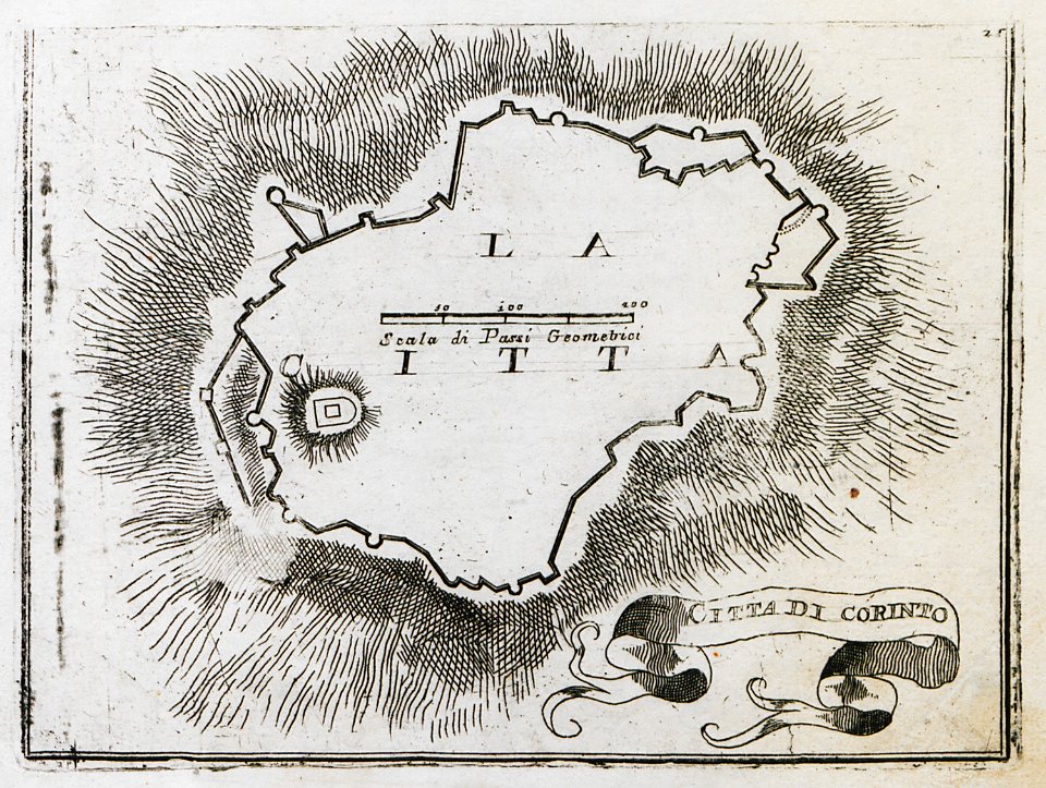
geographical illustrations by coronelli
old maps of the peloponnese
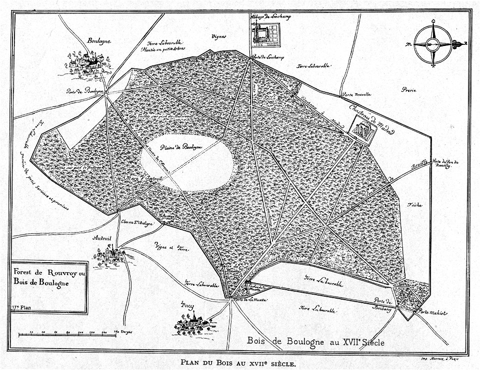
petite histoire du bois de boulogne
illustrations from h.corbel
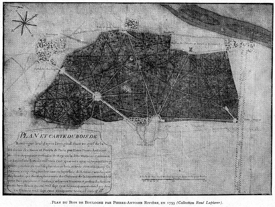
petite histoire du bois de boulogne
illustrations from h.corbel
8701 - 8800 of 33,250
Next page
/ 333